If you’re looking for a short, intense, few hour hike with INCREDIBLE views, Brunswick Mountain is the one for you. This blog will contain information around location, duration and maps, type and difficulty of terrain, packing essentials, and helpful tips. For context, please keep in mind that I am a 22 year-old male, who is quite physically active, so I will try my best to give unbiased estimates regarding this hike, but duration and difficulty is subjective to the individual.
Location: The parking lot for Brunswick Mountain hike is located just off of Highway 99, approximately a 40 minute drive from Vancouver. The parking lot is small, with room for only around 15 cars. Parking costs 3$/hr of 24$/day. Parking directions are unclear if the 24$ is for a calendar day, or a 24 hour period. However, we paid the 24$ as we made this hike into an overnight trip, and when we arrived back at the car the next day (approx 30 hours after paying) we were fine and didn’t have a ticket. Below is a Google Maps link to the parking lot. https://www.google.ca/maps/place/Sunset+Trailhead+Public+Pay+Parking/@49.4706866,-123.2373695,17z/data=!3m1!4b1!4m6!3m5!1s0x548669c07da0facf:0x92296f1579771e6c!8m2!3d49.4706866!4d-123.2347946!16s%2Fg%2F11hz5vzk19?entry=ttu&g_ep=EgoyMDI1MDExMC4wIKXMDSoASAFQAw%3D%3D
Duration and Maps: The total time from the parking lot to the summit took 3.5 hours, and we took short breaks only around once an hour. On the way down, it took us 4.25 hours, as we needed to take more breaks as the decline is quite hard on the knees. This map is helpful to see length and elevation! https://www.outdoorvancouver.ca/featured-trail-brunswick-mountain/
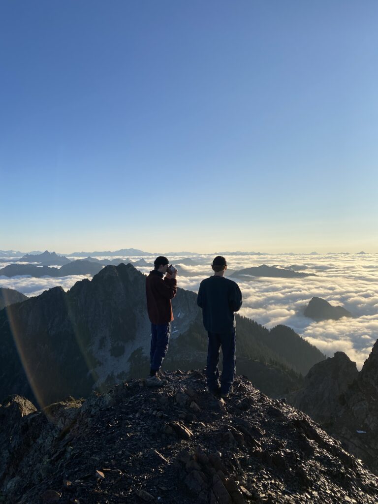
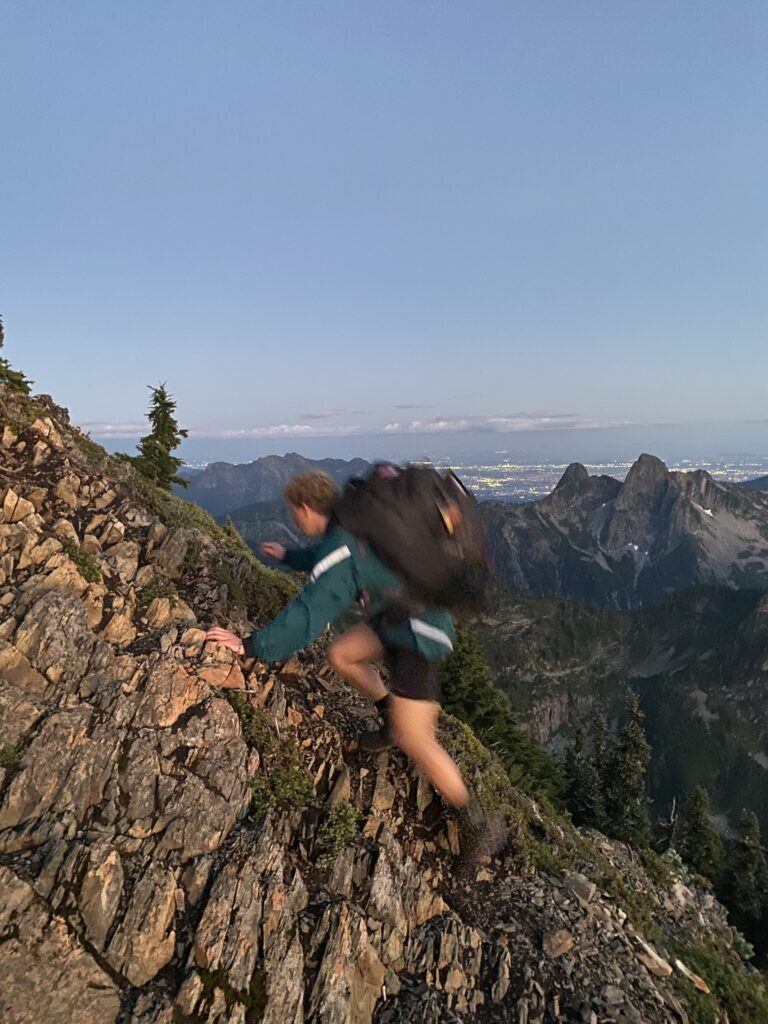
Difficulty: The terrain is split into segments. The first 2 hours are very easy, with gradual but continuous incline, hiking along a very wide gravel path that appears to have been used as a logging road at some point. The next hour begins to climb quite vertically, with occasional peekaboo views of the mountains and ocean. This segment involves climbing over tree roots and stumps. Poles recommended. The next segment becomes a scramble, and hands and feet are both used for most of it to add grip and support. The final segment is very short (approximately 7 minutes), but involves walking along a narrow ridge with steep drops on each side. Using both hands and feet are somewhat required for this part.
Packing Essentials: This hike could be done as an out-and-back if leaving early in the morning. NOTE: This hike would be very dangerous to do in the dark, so ensure more than enough daylight hours when starting. Check out my other post for a full list of packing essentials for out-&-back day hikes, and overnight backpacking. *We did this hike at the end of August, and although full sun, the temperature at the top was very cold, and varied between 1-2 degrees celsius at night. There are also many friendly mice that will try to steal your food! A scent-proof food bag is essential.

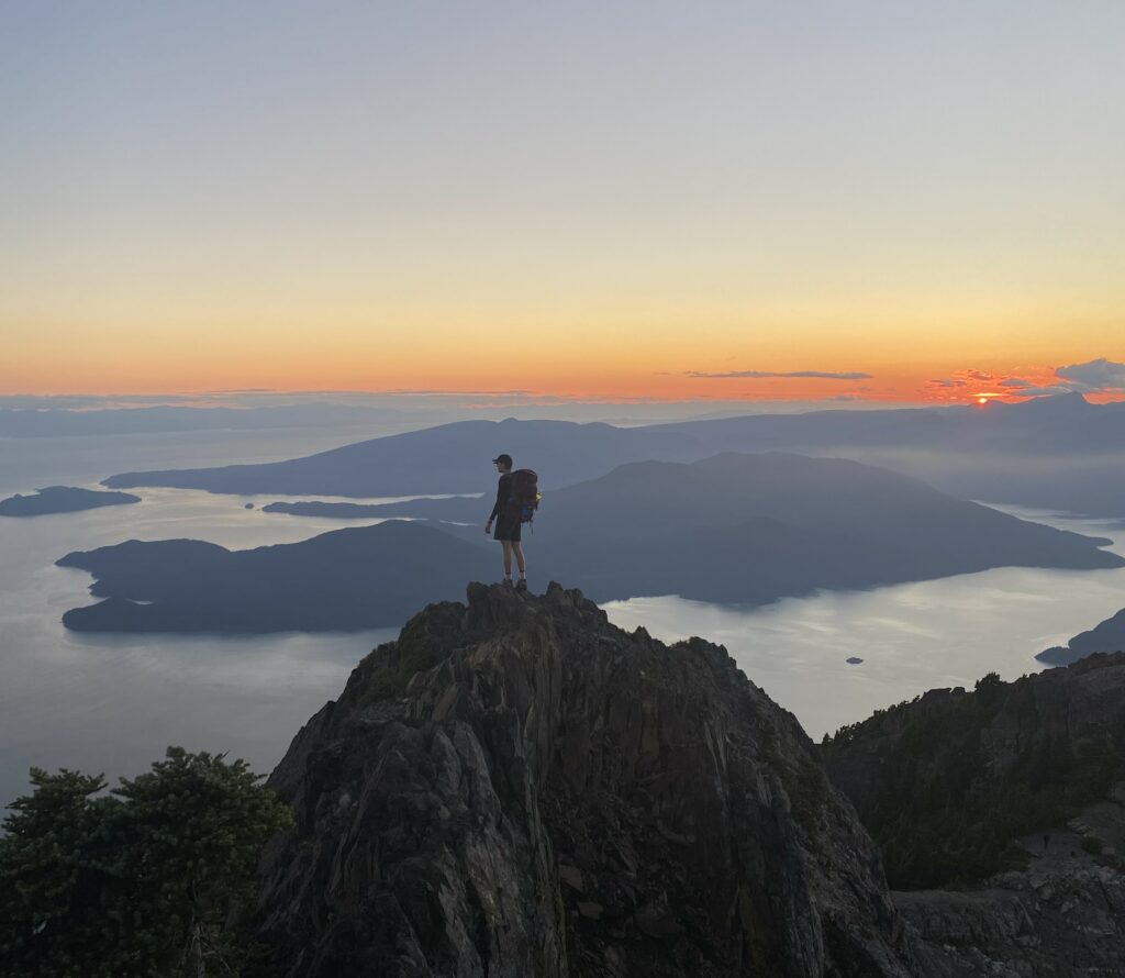
Helpful Tips: Hiking poles would have been nice! We did not bring them, so we found pole-sized sticks and used those for the first 3/4 of the hike. Pictures simply do not do justice to the beauty of the views. Aim to go on a clear-day with high-to-perfect visibility. If you want to experience sunrise and sunset on the summit, I HIGHLY recommend camping at the top! Tent space is limited, (no real designated area, but a few somewhat flat-ish spots) so you have to get creative. The sunset is stunning over the ocean, and the sunrise is equally as stunning with 360 degree views of all the surrounding mountains. Due to the elevation, Brunswick can experience an inversion (being above the clouds), which created a unique sunrise experience. I thought the trail was very well-marked, however having a subscription to AllTrails+ was handy, as it shows your location on the map, points which direction to keep hiking in, and tracks how far you have gone.