If you have a hiking or backpacking trip coming up soon, here’s a list I’ve curated of my favorite websites that provide useful information to know before beginning your trip!
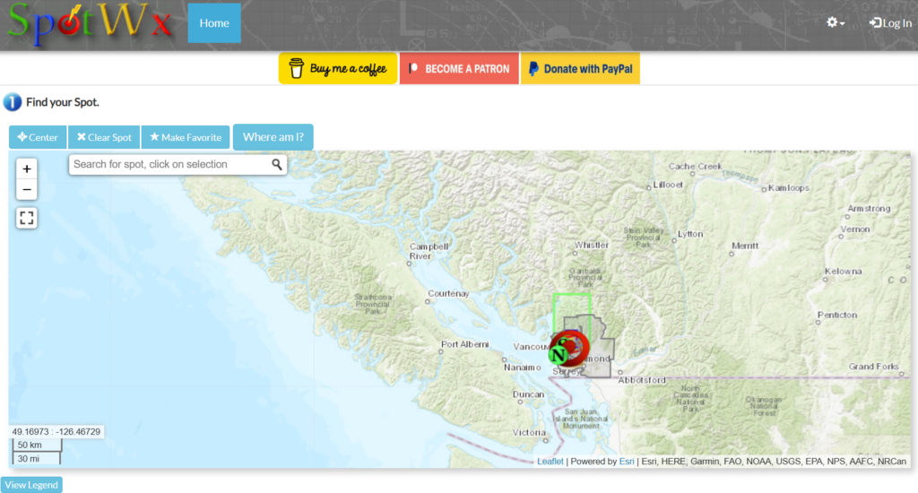
Spot WX: (https://spotwx.com/) Spot Wx is a phenomenal weather website that uses geolocations to give precise weather forecasts for an area. This website provides specific and accurate information for precipitation, wind, daylight hours, sunrise and sunset times, and temperatures. The best feature is often there is 2 day, 3.5 day, 5 day, and 7 day predictions. Of course the smaller the number of days the more accurate the prediction will be. The maps can sometimes be challenging to read, but they have a key to help you decipher the information.
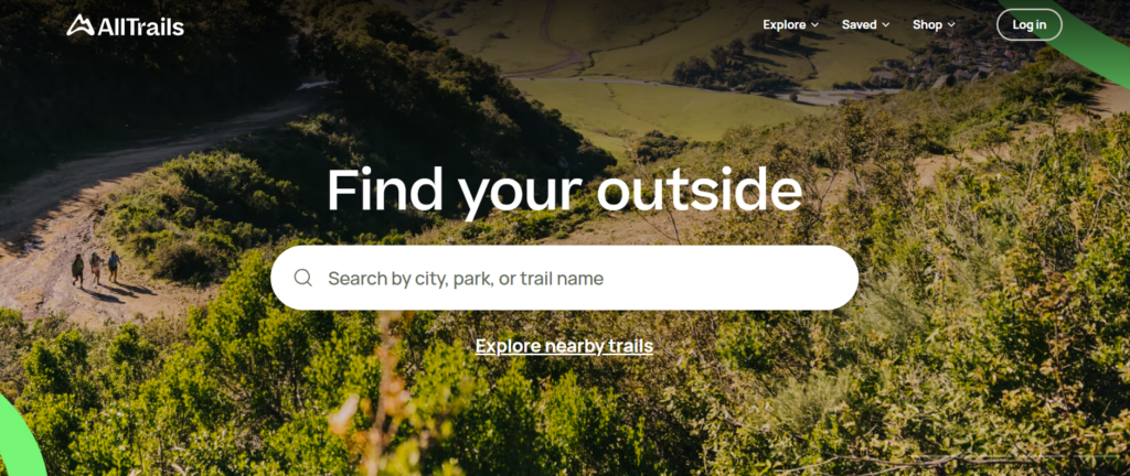
AllTrails: (https://www.alltrails.com/)This website and mobile app is by far my favorite. I do pay a yearly subscription of 40$, but it is SO worth it. This app gives you detailed trail maps, trail reviews, pictures, and has a GPS feature that tracks you along the trail. If I am ever unsure of which direction a trail goes, I quickly pull out AllTrails and a helpful arrow will point me in the right direction. This is an AWESOME gift to give to any of your hiker friends!
Outdoor Prolink: (https://outdoorprolink.com/) This is my favorite website for when I am looking to buy new outdoor gear. Creating an account with Prolink is only available for certain individuals who currently have a job or career related to the outdoors. The basis of the website is to give these individuals coupons or specialty deals on gear and equipment! These deals are sometimes up to 30 or 40% off (which quickly adds up if it is a multi-hundred dollar piece of gear)!! If you are curious about if you are eligible, check out their website and there is a long list of criteria. If still unsure, you can reach out to them or to your employer to see if this is a tool accessible to you!
If you are about to go on a hiking or backpacking trip (either alone or with friends) make sure you have taken all the necessary safety precautions before embarking on your journey. I have created a checklist of questions that you should ask yourself before you leave for your trip! Answer each question and follow the appropriate steps to complete the requirement.
Have you done research on the difficulty of the trail, and is it suited for your physical fitness level?
What is the forecasted weather, and is there a possibility it will change for the worse?
Have you packed all the 10 Essentials? (If wondering what this is, check out my other post “Packing Essentials”).
Have you informed a close family member or friend of your trip, and given them an itinerary of where you will be and how long you will be gone?
If you are going out of service, have you packed a GPS messaging device? If not, have you informed a close friend or family member about the duration of the trip, and how long to wait without hearing from you until they must contact emergency services? (Search & Rescue).
If applicable, have you obtained the proper permits or permissions to access this trail?
Do you have all the necessary gear/equipment to be safe on this trail?
Always better to be safe than sorry! The world is beautiful to explore, but ensuring you and your party will be safe should be your top priority! Never compromise your safety in the hurry to experience a trail 🙂
If you are going on a hiking or backpacking trip soon, don’t fear!! I have created a list with all the equipment, gear, clothes, and often-forgotten items that you will need to pack! Check it out below:
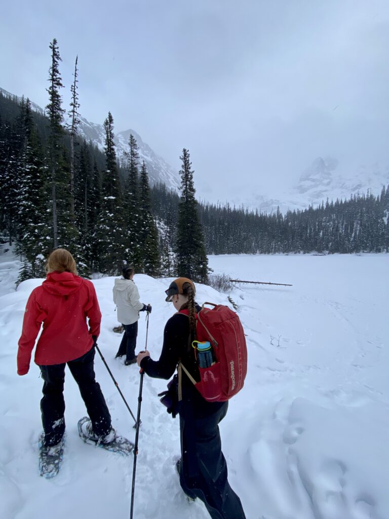
Last week some friends and I hiked Joffrey Lakes in Pemberton, BC. I had done this hike before during the summer season, but there was something very special about doing it in winter! Of course the lakes themselves were frozen over and covered in a sheet of snow, but still getting to experience a hike in the mountains was enjoyable all the more.
Location: Joffrey Lakes is located just a 30 minute drive out of Pemberton, and has a decent sized parking lot. Due to it being the off-season, we were 1 of 2 cars in the whole lot! The road leading up to the parking lot was plowed, yet snow-tires are recommended as there are some steep climbs and winding roads.
Duration: The hike itself is 7.4km round trip with 485m of elevation gain, and is generally estimated to be around 4 hours round trip. Due to it being snowy, we took around 1.5 hours to hike up as the trail was empty and we had the proper gear, but around 2.5 hours on the way down, as the temperature had dropped slightly and there were some icier patches that we wanted to be careful on.
Type of terrain/difficulty: The terrain is relatively easy, as the elevation is slow and gradual, and the trail is not overly tedious (never needing to use hands and knees). The trail is very scenic as it meanders through the forest, passing by the first lake after the first 300m, and then the next two lakes at km 2.8 and 3.6.
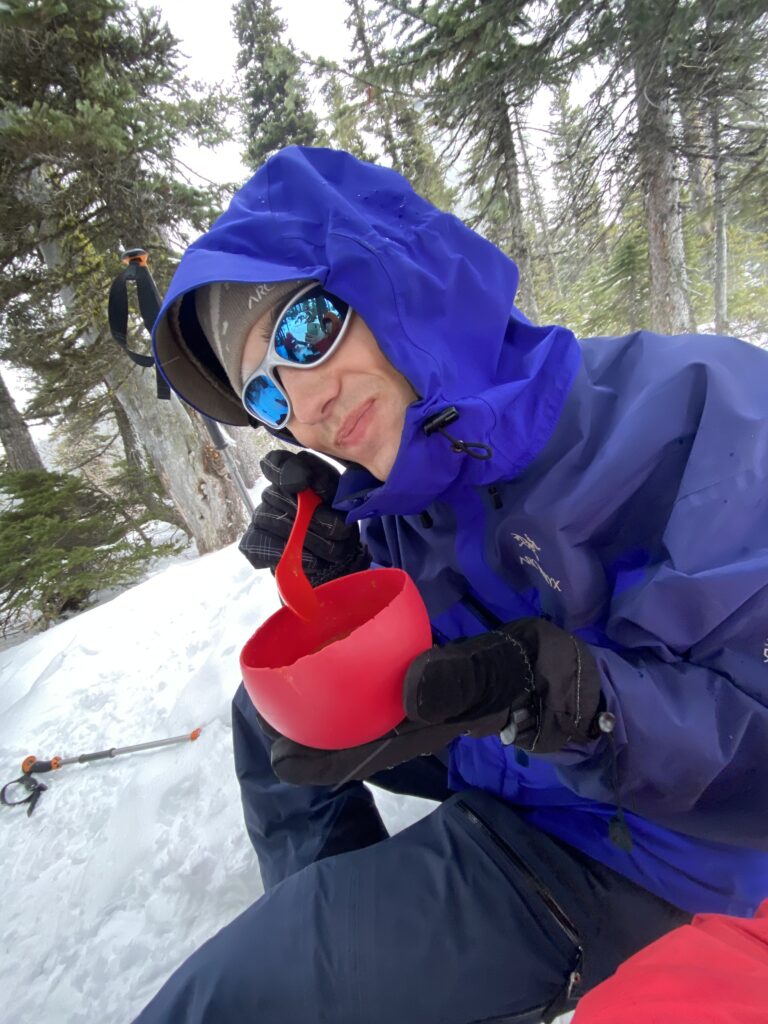
Packing Essentials: The trail is quite far from civilization, and cell reception was spotty and sometimes null. For the summer season, the trail is so busy and park rangers are always present that having a satellite radio such as an In-Reach is likely not needed, however for the winter season this was a good precaution in case anything were to happen. We also had all our 10 essentials with us (see my other post for the full list), as well as wearing fully waterproof gear, cramp-on attachments or snowshoes, and balaclavas and sunglasses to protect our face from the snow. Pro-tip: Bring warm soup or chili in a thermos!! We had the most delicious meal at the final lake, definitely worth carrying the extra weight 😉
I would highly recommend this hike for the summer or winter season! Be sure to plan ahead to reserve a spot in the summer, as the reservations fill up incredibly fast!
The Sunshine Coast Trail (SCT) is a 180km trail that tours along the sunshine coast of BC. The trail is very well-marked, and has multiple entrance and exit points that allow hikers to conquer a small segment, rather than having to tackle the entire trail. The purposes of this article will be to share the itinerary that I did, and give some helpful tips were I to hike this trail again!
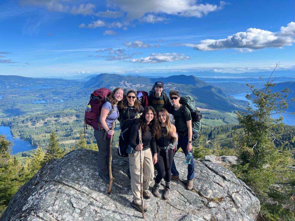
I, along with a group of 5 other friends, backpacked a 35km segment of the SCT in early June. We hiked the section from Tin Hat mountain to Inland Lake. We were incredibly blessed with (mostly) good weather, as the first 2 days were quite sunny and a comfortable temperature, and only the last day did we endure heavy rain for our final 10km push.
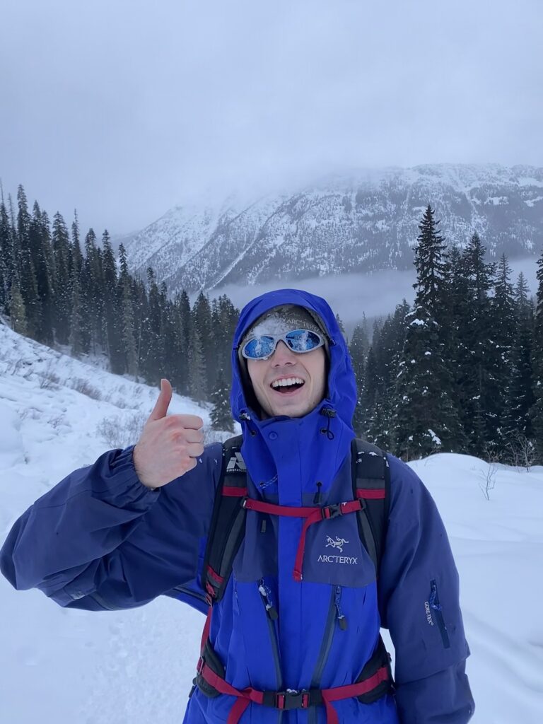
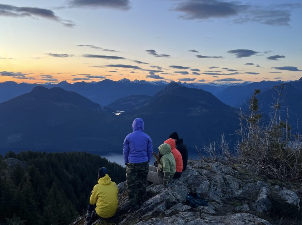
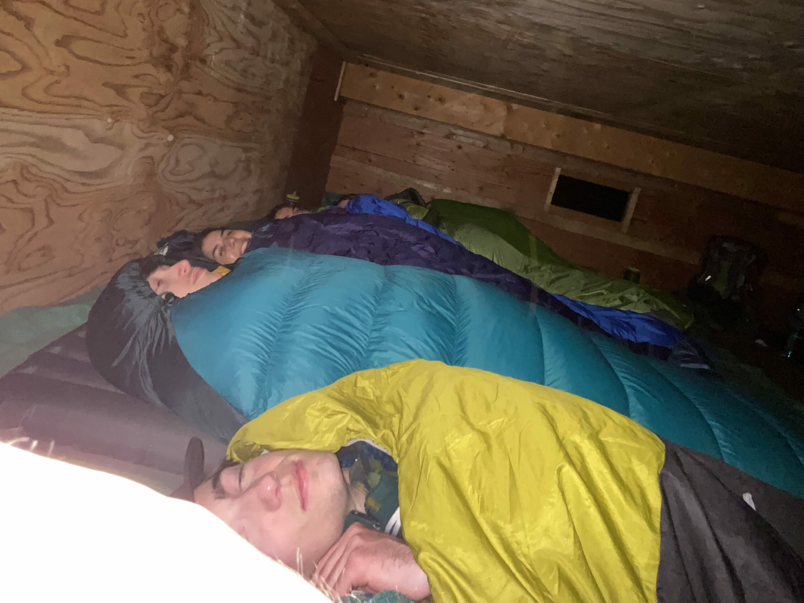
Day 1: There were 6 of us, so we took 2 cars to the base of the SCT. Here comes the challenging part: We parked 1 car at the base of Inland lake in the parking lot, and then piled 6 adult passengers AND 6 large hiking backpacks into one car. To say we were packed like sardines is an understatement. We then drove from Inland Lake parking lot up a long gravel road to get to the base of Tin Hat Mountain. This drive was just under 1 hour (~55 minutes). The car didn’t have 4×4 and we were fine, however we had to take it slow due to the number of potholes. We then parked the car in the small pullout area near the end of this gravel road, and began the hike. The terrain was a fairly constant uphill climb, so hiking poles may have been helpful. However, the ascent never required using hands and legs (it wasn’t THAT vertical thankfully). The total distance of this day was only around 4.5km. The view from the top was awesome, and we saw a gorgeous sunset! The hut itself was full already, but multiple tent pads were open, so we had our choice of tent site. Bear caches were provided for our food. The wind was very strong and very cold, so our warm layers and cold-rated sleeping bags were much appreciated!! Below is a pic of us at the summit of Tin Hat Mountain, and the sunset at the top 🙂
Day 2: We woke up and ate breakfast at the top of Tin Hat mountain, and then hiked for just over 7 km to Fiddlehead landing. This section was pretty, but almost entirely downhill, with some parts being very steep and requiring slow and braced steps. Be prepared for your knees to hurt. However, the path was very well marked, so we always knew where we were going. We ended up accidentally camping at the old Fiddlehead campsite as we were extremely tired from the sheer decent. The real Fiddlehead campsite was approximately 1km further, but we didn’t realize it at the time, as we hadn’t seen pictures of Fiddlehead to reference.
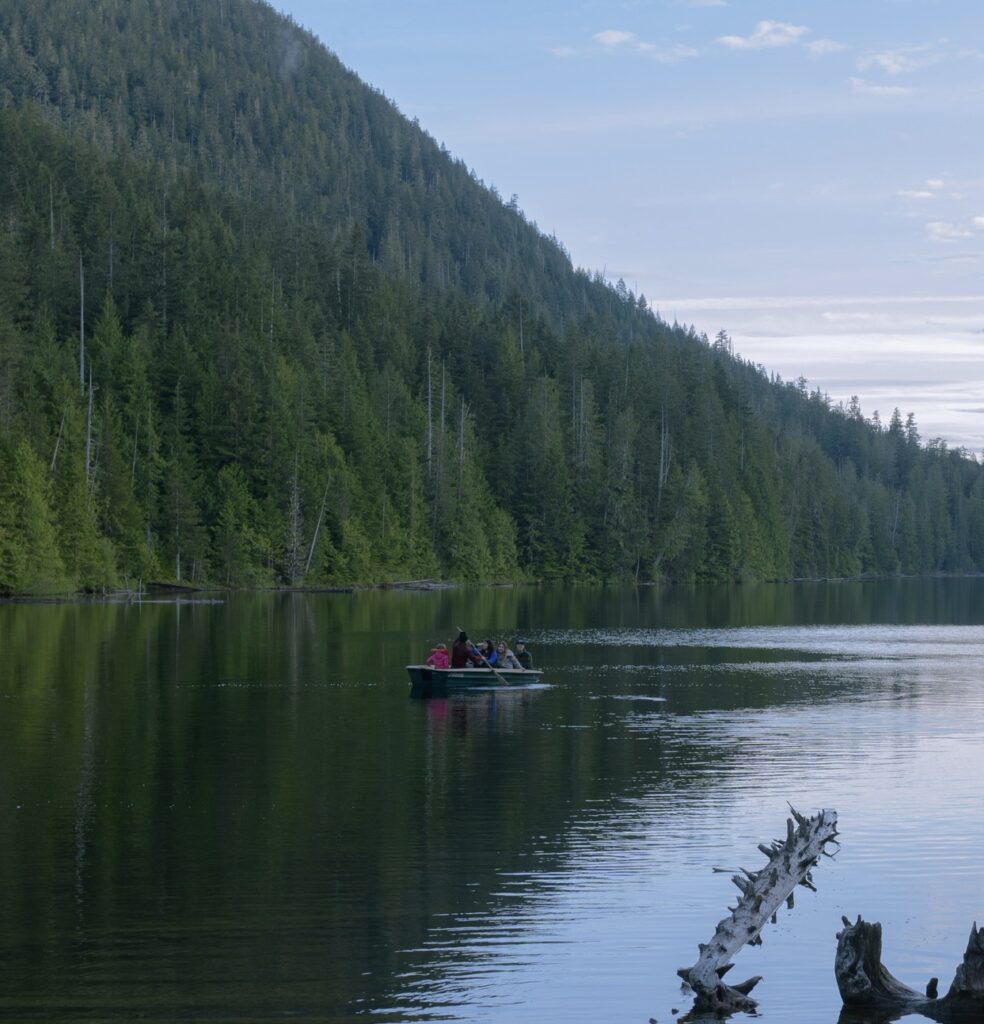
Day 3: Again we woke up quite early to eat breakfast and then get a head start on the day. We hiked to Confederation lake, which was just over 8.5 kilometers, and a lot of up and down terrain. We got the occasional peak-a-boo view, but mainly were hiking through forest. We were then greeted by Confederation Hut that is situated right on Confederation Lake. There is a nice picnic table, bear caches, and even a rowboat! We stayed in the hut in the lowest level (door is around the back of the hut). We were comfortable able to fit 6 of us, and have our bags by our feet.
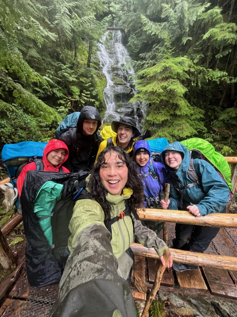
Day 4: We woke up to POURING rain. How fun. We had a 10km hike ahead of us to get to Inland lake. We came prepared with our rain gear though, so we geared up and began our hike. This part was probably the easiest of the 4 days, and had some gradual ups and downs, and the occasion steep incline or decline. Even though we were fully in tree cover, the rain was pouring so hard that we were still drenched rats. Once we arrived at Inland we were very cold, very wet, but honestly having the time of our lives! Something about backpacking with friends is just a blast no matter what. 🙂 We then drove back to the ferries to head home.
This trip was truly unforgettable. Not just because of the amazing people I went with, but because of the variety of terrain, stunning views, and (mostly) great weather. One of the best perks of the SCT is the ability to lengthen/shorten your trip to your liking. For us, we decided ahead of time to backpack the segment that we did, but we met other hikers along the way who were doing longer 5 or 6 night trips, and some who were just doing 1 and 2 nights. Would highly recommend this trip to anyone looking for an amazing outdoor adventure 🙂